ATPL Topic: Basis of General Navigation

Navigating the vast skies is a cornerstone of aviation, essential for every aspiring pilot aiming to conquer the skies. Mastering navigation isn't just a skill—it's a necessity. From ancient explorers navigating by the stars to modern-day pilots utilising cutting-edge technology, the art, and science of navigation have been central to safe and efficient flight. Join us as we explore its core principles, tools, and crucial subtopics outlined in the ATPL syllabus.
Table of Contents
Examples of General Navigation Exam Questions
Introduction
Navigation in aviation refers to the process of determining and controlling the position, direction, and speed of an aircraft during flight. It involves using various tools, techniques, and systems to accurately determine the aircraft's location relative to its desired destination and to navigate safely through airspace. Navigation is crucial in aviation for several reasons:
Safety
Efficiency
Compliance
Weather Avoidance
Emergency Situations
Exam Overview
Number of Questions: 55
Exam Duration: 2 hours 15 mins
Difficulty: Medium to Hard
70% of papers passed
The subject of General Navigation, which encompasses complex navigational techniques and theories, frequently presents a significant challenge for pilot trainees. Insider insights reveal that General Navigation (Gen Nav) specifically tends to pose more difficulties for students than other ATPL exams, which may rely more on theoretical understanding.
Featuring 55 questions and lasting 2 hours and 15 minutes, the Gen Nav exam is rated as medium to hard in difficulty as one of 13 ATPL subjects. It assesses your good understanding of navigation principles, charts, and timekeeping. It also demands the practical application of concepts in real-time scenarios, which adds another layer of complexity, requiring meticulous attention to detail. Additionally, mastering navigation techniques and interpreting various navigational aids can be challenging, especially for those without prior experience in aviation. Despite the challenging nature of the test, typically 70% of pilot students have managed to pass the exam, achieving 75% of the right answers.
Pay attention. In EASA licence theory exams electronic navigational computers are strictly prohibited, with only mechanical models based on a circular slide rule permitted for use. This restriction underscores the importance of professional pilots possessing fundamental navigation skills and the ability to perform calculations manually, ensuring they can navigate safely and effectively in various flight scenarios.
Subject Syllabus
In the ATPL course, the General Navigation subject syllabus contains 5 extensive sub-topics. Let's have a brief look at each of them.
061 01 Basics of Navigation
Navigating the skies begins with understanding the fundamental concepts of navigation, such as the solar system, latitude and longitude, magnetic variation, and distance measuring techniques. Understanding these building blocks will make more advanced topics easier to grasp.These navigation principles form the foundation of aviation navigation, allowing pilots to navigate safely and accurately during all phases of flight.
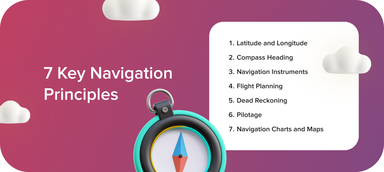
Key navigation principles include:
Latitude and Longitude: Latitude and longitude are geographical coordinates used to specify locations on the Earth's surface. Latitude measures north-south position, while longitude measures east-west position. Pilots use latitude and longitude coordinates to plot their position on a map or chart.
Compass Heading: A compass heading indicates the direction in which an aircraft is flying relative to magnetic north. Pilots use a magnetic compass or magnetic heading indicator to maintain a desired heading and navigate along a specific course.
Navigation Instruments: Aircraft are equipped with various navigation instruments, including GPS (Global Positioning System), VOR (VHF Omni-directional Range), ADF (Automatic Direction Finder), and DME (Distance Measuring Equipment). These instruments provide pilots with accurate navigation information, such as position, heading, distance, and ground speed.
Flight Planning: Flight planning involves determining the route, altitude, fuel requirements, and other parameters for a flight. Pilots use navigation charts, maps, and flight planning tools to plot the course, identify waypoints, and calculate headings and distances between waypoints.
Dead Reckoning: Dead reckoning is a navigation technique that involves estimating the aircraft's position based on its known starting point, course, speed, and time. Pilots use dead reckoning to navigate between waypoints and checkpoints, updating their position as they progress along the planned route.
Pilotage: Pilotage is the visual navigation technique of using landmarks, terrain features, and other visual references to navigate. Pilots use pilotage to identify key landmarks, checkpoints, and navigation aids along the route, confirming their position and orientation.
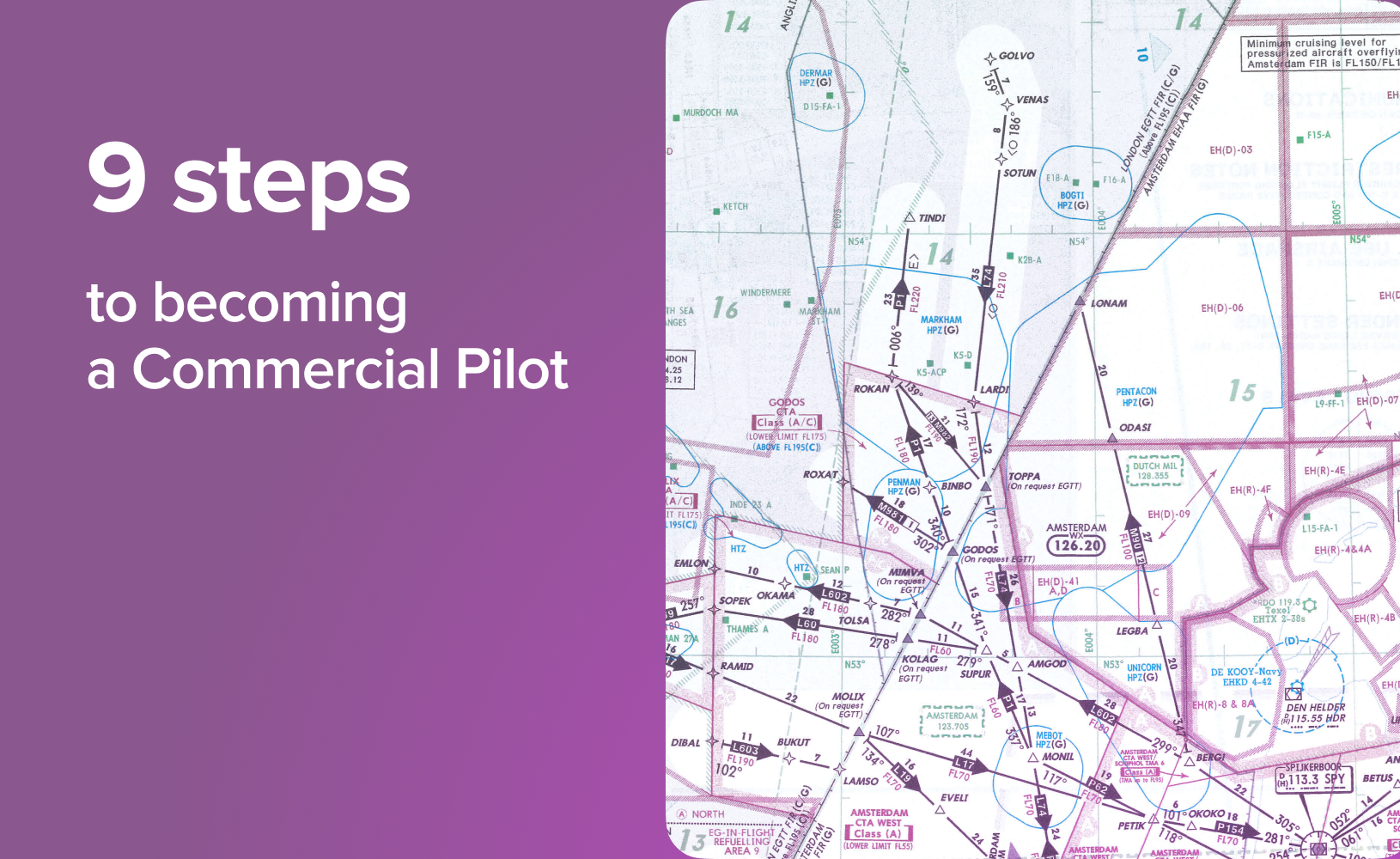
Navigation Charts and Maps: Aviation charts and maps provide detailed information about airspace, terrain, navigation aids, and other features relevant to navigation. Pilots use sectional charts, en route charts, and approach plates to plan routes and navigate safely within controlled and uncontrolled airspace.
061 02 Visual Flight Rules (VFR) Navigation
This involves planning and executing flight operational procedures based on visual references and landmarks, rather than relying solely on instruments. For instance, pilots must accurately interpret visual cues such as roads, rivers, and geographical features to navigate safely, especially in areas with limited navigational aids.
VFR communications refer to the communication procedures used by pilots and air traffic control (ATC) when operating under visual meteorological conditions (VMC). In VFR flying, pilots rely primarily on visual cues to navigate and maintain separation from other aircraft, with communication serving to enhance situational awareness and coordinate with ATC as needed.
For example, pilots frequently use landmarks and visual cues to navigate, especially during VFR flights, where relying solely on instruments might not be feasible.
Examples of VFR communications include:
Departure Calls: Pilots typically make radio calls to announce their departure from an airport or airspace, stating their aircraft type, call sign, and intended direction of flight.
Position Reports: While en route, pilots may provide periodic position reports to ATC or other traffic in the area, indicating their current location, altitude, and intentions.
Traffic Advisories: Pilots should communicate with other aircraft in the surrounding area to exchange traffic advisories and maintain visual separation, especially in congested airspace or near aerodromes.
Navigation Assistance: Pilots may request navigation assistance from ATC, such as requesting vectors or deviations from their planned route to avoid weather or traffic.
Arrival and Landing Calls: Pilots announce their arrival and intentions when approaching an airport, including entering the traffic pattern, requesting landing clearance, and announcing their position.
Overall, VFR communications aim to promote safe and efficient flight operations by facilitating clear and effective communication between pilots and ATC, enhancing situational awareness, and promoting the orderly flow of air traffic in visual flight conditions.
061 03 Great Circles and Rhumb Lines
Understanding the concepts of great circles and rhumb lines is crucial for efficient route planning and navigation. While great circles represent the shortest distance between two points on a sphere, rhumb lines provide a constant compass heading. Pilots often use great circles for long-haul flights to minimise fuel consumption and flight time, while rhumb lines are preferred for shorter distances or when maintaining a consistent heading is essential.
061 04 Charts
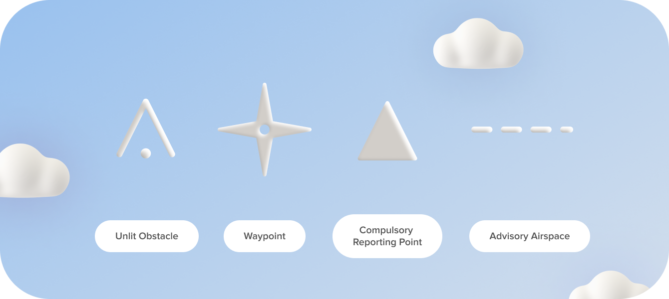
Charts serve as invaluable tools for pilots, providing essential information about terrain, airspace, navigation aids, and other relevant details. Pilots must familiarise themselves with various types of charts, including sectional charts, en route charts, and approach plates, to plan and execute flights safely. For example, studying sectional charts helps pilots identify landmarks and navigate around restricted airspace, ensuring compliance with regulations and safety standards.
061 05 Time
Time plays a critical role in navigation, facilitating accurate calculations and ensuring timely decision-making during flights. Pilots must master timekeeping techniques and understand concepts such as Coordinated Universal Time (UTC) and time zones to synchronise flight plans and adhere to schedules. For instance, calculating estimated time of arrival (ETA) requires precise time management skills, considering factors such as wind speed, altitude, and fuel consumption.
7 Study Strategies to Succeed in Mastering General Navigation
Here are some tips to help you assimilate and understand the knowledge of General Navigation for your ATPL:
Start with the Basics: Begin by thoroughly understanding the fundamental concepts of navigation, including latitude, longitude, magnetic variation, and basic navigation methods. Establishing a strong foundation will make it easier to grasp more advanced topics later on.
Break it Down: General Navigation can seem overwhelming at first, so break down the material into manageable chunks. Focus on one concept or technique at a time, and practice until you feel comfortable before moving on to the next.
Utilise Visual Aids: Visual aids such as diagrams, charts, and maps can greatly enhance understanding. Use them to visualise navigation scenarios, plot courses, and identify key landmarks. Interactive online tools and simulator software can also be valuable resources for hands-on practice.
Practice Regularly: Consistent practice is essential for mastering navigation skills. Set aside dedicated study time each day or week to review concepts, work through practice problems, and simulate navigation scenarios. The more you practise, the more confident and proficient you will become.
Seek Clarification: Don't hesitate to ask questions or seek clarification from your instructors or peers if you encounter difficulties or confusion. Remember that everyone learns at their own pace, and seeking help when needed is a sign of dedication and commitment to your learning journey.
Apply Theory to Real-World Scenarios: Connect theoretical knowledge to practical applications by studying real-world navigation charts, flight plans, and navigation logs. Consider taking part in navigation exercises or flying lessons to apply what you've learned in a hands-on setting.
Stay Positive and Persistent: General Navigation can be challenging, but with patience, perseverance, and a positive mindset, you can overcome any obstacles. Celebrate your progress along the way, and remember that each step forward brings you closer to achieving your goals.
By following these recommendations and approaching General Navigation with dedication, curiosity, and a willingness to learn, you can develop the skills and confidence needed to navigate the skies with precision and accuracy.


